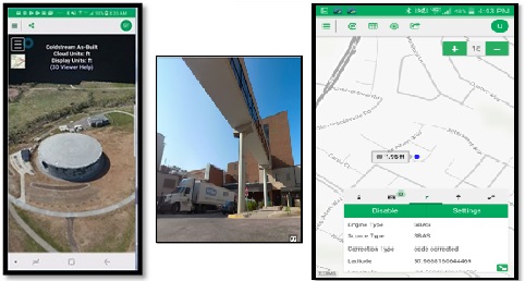
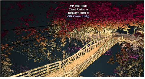
Simple Yet Powerful

The foundation of GeoSync GO is based on three essential activities

Visualization

Our service helps to exhibit data 2D and 3D data in a way that is intuitive and impactful. We have created a system that gives precise control over how information is displayed. Viewers included for 2D Maps, 3D Point Clouds and 360 Photos.

Capture

Capture and publish GIS data as well as point clouds from any source to keep data up to date and available to your important work processes. Proven data capture and publishing work flows are included and easy to use.

Management

Our geospatial management tools are targeted toward making it easy to maintain, share, and organize all of you 2D and 3D data sources, including GIS layers, 3D point clouds and 360 images.

Powerful 3D Tools

Point cloud processing and visualization tools for Aerial LiDAR, terrestrial and mobile scanners, and drone photogrammetry data sets. 3D Publisher and ZTools assist in finding public 3d data, preparing the data for CAD workflows, creating shareable viewers and overall data management. Close your 3D data gap with GeoSync GO 3D Tools and capture the full value of your 3D investment.

Everyday technology for everyday work

GeoSync GO utilizes the accessbility of phones and tablets to replace specialized equipment. The learning curve is reduced by focusing on devices that users already understand. The affordability of our services combined with low cost mobile technology allows more people to be involved in everyday tasks.

So many possibilities

Administrators for utility systems, emergency management services, property valuation and law enforcement already rely on GeoSync GO to increase their effectiveness. We think that is just scratching the surface. We are always looking for more areas that need fresh solutions and are eager to work with anyone who thinks GeoSync GO meets their needs.

Contact Us